Показаны сообщения с ярлыком Catalonia. Показать все сообщения

вторник, 11 декабря 2018 г.

Castles of Spain: Castellvell in Solsona, Catalonia, Pyrenees

Castellvell (Castellvell de Solsona) is a castle located on top of a hill of 838 meters with the same name in the municipality of Olius in the Solsona district, three kilometers from the city of Solsona (Lleida, Catalonia).
The building dates back to the 11th century. This is one of the most important military fortifications and watchtowers in the north-west of the city of Solsona. This architectural monument was declared a cultural object of national importance in Catalonia.
The construction of the castle began on the order of Count Sunyer d’Urgell in 957. In 973, Earl Borrell II of Barcelona strengthened it as a military citadel to ensure the defense of the area. In the 11th century, Lord of Solsona Ecard Miró continued to strengthen the castle. The construction was completed (after his death) by the descendants Bernat and Ramon de Tarroja in 1217. The construction was completed when the heir of the Tarroch family, Agnes, married the viscount of Cardona, Ramon Folc IV de Cardona (1180-23 August 1241).
From the Romanesque period, a three-apse and west facing church remained in the complex, which corresponds to the parish church of Salsona San Miquel de Castellvell.
In the castle there is also a sample of the Romanesque chapel, but in the XV century the chapel was rebuilt in the Gothic style.

четверг, 29 ноября 2018 г.

Montesquieu Castle

Montesquiu (cat. Montesquiu) is a municipality in Osona, in Catalonia, Spain. It is located on the banks of the river Ter in the north of the region. The municipality is located on the main route (C17-N260) between Barcelona and Puigcerda.
The main tourist attraction of the municipality is the 13th century Montesquieu castle. It is open to the public, and in the summer many cultural events are held there.
Montesquieu Castle first appeared in documents dating back to 1285, when it was part of a defensive triangle that included the medieval castles of Besor and Saderra.
The transformation from the defensive complex to the Montesquieu castle took place in the 14th century when the regional governor moved here from Besora.
Over the next few centuries, the castle underwent several structural changes. Its owners have expanded the living space. They also added a small chapel set aside for Saint Barbara.
The Provincial Council of Barcelona acquired the castle in 1976.
Today the castle is the central element of the park that bears its name. In the park around the castle are two pedestrian routes: three and eight-kilometers long.
Montesquieu Castle is an amazing and beautiful place. It creates an impression of solitude, retreat, and sometimes loneliness.
The gothic staircase, due to the glass ceilings above and large windows, is the brightest place in the castle. The penetrating rays of the sun add warmth and comfort to the interior of this seemingly harsh stone structure. Darkness cannot rule here until the sun shines.

Cardona

Cardona (cat. Cardona) is a city and municipality in Spain, included in the province of Barcelona as part of the autonomous community of Catalonia. The municipality is part of the Bajes district. It covers an area of 66.70 km². It had a population of 5182 people in 2010.
Cardona is located in the valley of Salina. Salina Valley (La Vall Salina) is a place where natural salt layers have formed over several million years. The mountain range has the shape of an elongated ellipse. The massif borders the Cardener River in the east, the Tresserres mountain range (Tresserres) in the south, Gran Bofia (la Bòfia Gran) in the west and the Sierra (the city itself and Cardona Castle) in the north. In total, the valley area encompasses 100 hectares. The whole territory is included in the State Plan of Natural Interests of Catalonia (el Pla d’Espais d’Interès Natural de Catalunya).
Mining has long been a crucial part of the location of the city and the castle of Cardona. The exploitation of salt deposits and the establishment of the viscountcy Osona (vescomtal d’Osona) in the castle led to the fact that Cardona Castle and the city created a powerful jurisdiction in the Cardenar River region between the 12th and 14th centuries. By the 15th century, the power of Cardona extended over a vast territory about 60 km long and about 50 km wide. Read more about the history of the region here.
Tourism and attractions in Cardona
Today Cardona with a population of 5,000 is one of the tourist centers of Catalonia. Every year more than half a million tourists visit the city, mainly from Spain and France.
Among the main attractions is the Castle of Cardona (El Castell i la Colo • legiata de Sant Vicenç).
Since ancient times, man has sought places on high ground to build fortresses that would allow him to control a territory. In Cardona, the geographical location of the castle corresponds to the need to protect access to the salt deposit and control over the valley of the Cardener River.
Built on top of a mountain to control the land around the Cardener River Basin, Cardona Castle was from the 11th to the 15th century the main residence of the Lords of Cardona. The castle complex is divided in half between the majestic pavilions and the canonical Romanesque chapel of Sant Vicenç. The architectural complex includes the Tower of Minion (Torre de la Minyona), the Ducal Palace (Pati Ducal), and numerous defensive bastions.
Cardona Castle is an excellent example of military fortification, which shows the evolution of military art from the Middle Ages to the modern era. The castle was home to one of the country’s most important noble families, and protecting the exploitation of salt mines meant that its fortification was impregnable. The power of the castle as a military fortification is proved by the fact that the castle was taken only once during the war for the succession of the Spanish king, Felipe 5 (1711-1714).
The chapel of Sant Vicenç is original, dating from the 11th century, and was consecrated between about 1029 and 1040. This is a magnificent example of Romanesque architecture which has a three-nave basilica plan. In the chapel there are also several tombs and pantheons belonging, in particular, to Duke Ferran I and Count Joan Ramon Folt I.
Currently, the castle is a four-star hotel, restaurant and cafe with a great view over the valley.
The castle is open to the public; however, guided tours are possible only on Saturdays and Sundays (tel. 93 869 24 75).
Among the museums of Cardona is the medieval center (Center Cardona Medieval) – another attraction of the city. Located on the Plaza de la Fira (plaça de la Fira), opposite the Cardona Town Hall, this center helps to highlight the city’s history and cultural heritage. The permanent exhibition with extensive graphic and audiovisual accompaniment explains the emergence and evolution of the city, and the construction of the fortress of Cardona, which has defended the city for over five hundred years.
A virtual tour offers a visit through the most significant historical sites, including visiting the parish church of San Miquel with its magnificent Gothic nave. The Church of Sant Miquel is an example of Catalan Gothic architecture. The church was consecrated in 1397. Inside the temple there are two side altars and crypts of holy martyrs.

History of Spain: Cardona – one of the main strongholds of independence of Catalonia

History of Spain: Cardona – one of the main strongholds of independence of Catalonia
For centuries, Cardona played a leading social and political role that left a legacy of monumentality and grandeur in general, which is especially valuable and attractive to current residents of the city and its tourists.
The first documented mention of Cardona is dated April 23, 986. On that day, Earl Borrell II provided the so-called Second Settlement Letter, which is currently preserved in the city’s historical archive. Archaeological excavations, however, prove that settlements in this place already existed before, as evidenced by the Iberian remains. They were found in the Salina Valley (Salina), which later became the center of Catalonia and enriched the local lords, defining the lineage of modern Cardona. The lords, viscounts, and dukes of Cardona subsequently were in power over this jurisdiction, and this is 6% of the territory of Catalonia.
The city of Cardona, found at the foot of the castle, was born by the end of the 10th century. The appearance of the castle and the city has determined the strategic situation in the region on the border with Al-Andalus: this is the intersection of paths between the province of Urgell, Cerdanya-Berga and Osona-Barcelona. The geo-strategic position, as well as the extraction of salt and its commercialization in Europe, will later turn Cardona into the political and commercial center of Catalonia.
The exploitation of salt deposits and the establishment of the viscountcy Osona (vescomtal d’Osona) in the castle led to the fact that Cardona Castle and the city created powerful jurisdiction in the Cardenar River region between the 12th and 14th centuries. By the 15th century, the power of Cardona extended over a vast territory about 60 km long and about 50 km wide. This is a region from the Valley of Lords (Vall de Lord) to Segarra within a radius of about 40 km around the castle and the city of Cardona. So the dynasty was born: first the barons of Cardona, later in 1319 the viscount appeared, in 1375 the county, later in 1491 the duchy of Cardona was formed.
Thus, Cardona became the site of the most important jurisdictional authority of the Principality, outside the early counties of the Carolingians. From here the fiscal and judicial administration of this vast territory was carried out.
The cornerstone of this administration was the court or ducal curia, around which various officials acted in the service of lords, such as the treasurer, judge and bailiffs, all of whom were headed by the prosecutor general or governor-general.
State power in the county duchy of Cardona was carried out using three “batlies”, or judicial demarcations, which divided the territory between the cities of Cardona, Solsona and São Llorenç de Morunys, to which was also attached Vegueria de Segarra, controlled from the cities of Calaf and Torà.
However, in the mid-15th century, the constant absence of lords in the castle led Cardona to lose political power in favor of other growing political and economic centers – the cities of Manresa, Servera, and Berga. In the following centuries, Cardona was destined to lose its empire during the economic, social and political events that took place throughout Catalonia. As a result, by the middle of the 17th century, the area under the control of the Lords of Cardona was reduced to 608 sq. km, while the population was not more than 2000 people, of which 45% lived in Cardona itself, and 55% on the surrounding land.

понедельник, 26 ноября 2018 г.

Salt Mountain Salins de Cardona – one of the major natural monuments of the Pyrenees

Salt Mountain Salins de Cardona – one of the major natural monuments of the Pyrenees
Excursions to the cave last 50 minutes. The temperature inside the cave is from 17 to 20 degrees, regardless of the season. For safety, you will be offered a helmet to wear.
photo: all-andorra.com
The entrance to the cave
The mineral that can be seen here everywhere — on the ceiling, on the walls, and on the floor — is salt. It has an orange-red color. This is due to the presence of iron, which in combination with oxygen forms oxides – give the salt its color. Hence the popular name is red salt.
Seeing this salt deposit, one would like to ask: how did a whole mountain of salt appear in the central part of Catalonia? To find out the answer, we must make a trip back in time – to go back 40 million years ago. At that time there was a huge sea in the center of Catalonia. It flowed from the peninsula from the north (at present it is the Bay of Biscay), and into the lands of Aragon. It was everywhere … However, later, due to the increase in temperature, the water gradually dried up.
The formation of salt layers occurred in stages. Salt was deposited in isolated areas of the earth’s surface, where new portions of seawater periodically arrived and, where due to the dry climate and, consequently, strong evaporation, the mineral became more and more saturated. Where these parts of the surface gradually descended, due to the tectonic movements of the earth’s crust, thick deposits were formed. First, halite was formed, then sylvinite, and ultimately carnallite (potassium and magnesium chloride).
The geological characteristics of the salt deposit allowed a person to use this raw material from the Neolithic period (2500 BC) to the present day. The Iberians who invaded the peninsula, the Romans who came here during the Middle Ages, as well as the lords of Cardona, were able to enrich themselves at the expense of the deposit, becoming “the lords of salt”. The Salins de Cardona deposit, due to the quantity and quality of salt, became famous in Catalonia. In 1900, the first underground mine appeared (it was abandoned in 1934).
Since ancient times, man has been producing salt for various purposes, such as preserving. However, the situation changed dramatically after the start of the production of inorganic fertilizers. In 1923, the Spanish Union, Union Española d’Explosives, S.A. bought Salins de Cardona deposit for 3.5 million pesetas. In 1925, this company launched a new project to extract sodium and potassium chloride from salt, which meant opening a new mine with two main wells, a processing plant, and establishing logistics to the port of Barcelona.
When in September 1990, both mines were closed, a total of 37,874,843 tons of mineral had been mined from the bowels of the earth, and mining had reached a depth of 1,308.7 m, which made Cardona the deepest mine in the country. At this depth, the temperature was above 50 degrees, the salt layers were not vertical, but horizontal, which required the introduction of a new production system. Each mine had its own name: Marie Thérèse (depth 720 m) and Albert (depth 1000 m. Development period: 1929 – 1972).
Santa Barba is the patroness of the miners, pyrotechnics, demolition men – everyone who deals with underground work, including mining. The holiday of Santa Barba is celebrated on December 4th – this is a very revered date in Cardona.
Next to the statue, you can see the stairs. Once they were wooden, but over time they became covered in salt as they were slowly forgotten about. Now it looks like they were originally made from salt.
The biggest “room” is called the Sistine Chapel.

пятница, 23 ноября 2018 г.

The Catalan city of Puigcerda – famous for its horse fairs and skiing

The Catalan city of Puigcerda – famous for its horse fairs and skiing
Puigcerda (Catalan Puigcerdà) is the capital of the Catalan comarca of Cerdanya, in the province of Girona, Catalonia, northern Spain, near the Segre River and on the border with France (it borders directly the French city of Bourg-Madame).
Puigcerda is a city with a population of 9,100 people. Puigcerdà is located on the banks of the river Segre, at an altitude of 1215 metres. Translated from the Catalan “puig” means “hill”. From the hill you can see the beautiful Cerdanya valley – the largest in the Pyrenees. On its territory there is a nature park Cadí-Moixeró, where you can come across rare species of animals and birds.
The city has its own media stations: two radio stations (the state-run “Radio Puigcerda“ and private “Radio Pyrenees”), a TV channel, a newspaper, and a free monthly magazine.
History of Puigcerda
The city was founded in 1177 by the king of Spain, Alfonso. The city has been famous for its fairs since 1182, in particular, its horse fairs which are famous throughout Spain.
It is worth recalling that since the days of Napoleon in France, the division of territories was into departments in France, and in Spain – in the province. So, from 1813 Puigcerdà was one of the four provincial capitals of Catalonia (along with Barcelona, Girona and Lleida).
In 1833, Spain was divided into two warring parties. One supported don Carlos and his heirs, the Carlist party. The other stood on the side of Isabella and her mother, Mary Christina, she was called the party of Christinos. Political strife has triggered three wars, called the Carlist wars.
These wars had a significant impact on the development of Puigcerdà. The city ceased to be the capital (Tarragona became the fourth capital), but this did not prevent it from developing dynamically – mainly due to agriculture, and later, from the beginning of the XX century, due to tourism.
Tourism and what to do
Tourism in Puigcerdà forms the main income of the budget, which currently stands at 13.5 million euros.
Lovers of active leisure and tourism in the mountains are main tourists. After the Spanish Civil war (1936-1939) the first ski resorts appeared here. The closest are La Molina and Masella, there are also ski resorts from France-Pyrénées 2000, Les Angles, etc.
A distinctive feature of the ski resorts of the Cerdanya plateau (Baixa Cerdanya – Spain, Alta Cerdanya – France) is the meteorological conditions. There is often good sunny weather and a lot of snow. It is also important that the ski slopes are on the sunny side of the Pyrenees. Here you can engage in all winter sports: Alpine and cross-country skiing (in the mountains), hockey, curling, figure skating (in a sports complex located in the city, which also has a large stadium, climatic pool, football pitch and tennis court).
The sports complex belongs to the city. The price for a subscription and a single visit is the cheapest in Catalonia.
In summer, mountain sports are also available in the region (mountaineering, climbing, hiking of different levels of difficulty, mountain and road biking).
There are also three Golf clubs near the town.

Cities of Catalonia: “Good luck city” as mark of the best European rafting city Sort (Lleida Province)

Cities of Catalonia: “Good luck city” as mark of the best European rafting city Sort (Lleida Province)
Sort is the capital of the provinces Pallars Sobirà, Lleida, Catalonia, Spain. The city is located at an altitude of 692 m above sea level, near the Noguera Pallaresa River, a tributary of the Segre River.
Population: 2.113 (in 2005). Population density: 20.4 / km²
Area: 105.13 km²
The name “Sort” in Catalan means “good luck”. The lottery ticket shop “La Bruixa d’Or” (“Golden Witch”) is the most famous in Catalonia. They say that this shop sells a lot of winning tickets – according to statistics, those who buy tickets from this shop are more likely to win.
The administrative division of Sort includes the traditional district of Sort, as well as the settlements of Llessui and Enviny that were joined in 1970. In 1976, Altron was also attached to the municipality. The territory of the municipality extends along the shores of the Sort, Barran de Montardit valley (Mall del Barranc de Montardi), Barranc de Santa Anna valley (vall del Barranc de Santa Anna) and almost all of the Val d’Asua valley (Vall d’Àssua).
In the north, the land is bordered by the municipality of Espot, in the north-east by Rialp, in the south by Soriguera, and in the west by Baix Pallars and Torre de Capdella.
Architectural sights and what to see
Sant Feliu de Sort is the parish church of the city, in the old municipal district, the Pallars district of Sobir. It is located in the city center, in the Plaza Mayor, opposite the C13 national highway. This monument of Romanesque architecture belongs to the objects of cultural significance and is protected by the state.
The church has three naves and a rectangular “back” facing the west. Tts facade is located at the foot of the nave. In the north-eastern part of the tower stands a powerful bell tower.
Sant Esteve de Castellviny – a parish church, is also included on the list of Spain’s architectural heritage sights. The church was built in a strictly Romanesque style. It is located in the suburbs of Sort.
The ancient fortress of the Counts of Pallars was presumably built in the 11th century. In the Middle Ages, the fortress served as a defense mechanism. In the era of civil wars in Spain, there were prisons in the citadel. Only in 2007, the local municipality opened a museum in this area. Museum expositions are devoted to the Catalan wars, including the era of the Second World War.

вторник, 20 ноября 2018 г.

The history of Catalonia: the city of Ripoll and the Romanesque monastery of Santa Maria

The history of Catalonia: the city of Ripoll and the Romanesque monastery of Santa Maria
The first mentions of the presence of people in Ripoll belong to the Bronze Age (1500-600 BC). This information refers to small, disparate settlements near the Ter and Freser rivers, surrounded by mountains. The findings of bronze objects and tools confirm these assumptions.
In the IX century, residents of the surrounding areas began to concentrate around the place that today is called the city of Ripoll. The initiator of the settlement in this area was Count Wilfred the Hairy (Guifré el Pelós) (840-897).
This historical character of French origin, considered one of the fathers of the Catalan nation, founded in 879 the Romanesque monastery of Santa Maria. The monastery was governed by a community of monks on the orders of St. Benedict. The first head of the monastic community was Abbot Oliba, whose name is associated with the main stages of the formation of the monastery as the center of lands in the area of Ripoll. These works were closely associated with the increase in the political, economic and jurisdictional power of the monastery in Catalonia.
For the sake of their security, the Ripolians settled near the monastery, which built a wall in the XIV century in order to guarantee peace for the population and not to be attacked from the outside. Security, as well as the construction of a water channel from the Fraser River, provoked the development of trade in the region. The water channel became the most powerful economic engine for the population and contributed to the development of industries such as iron processing, weaving, and woodworking.
In 1428, however, the monastery and its walls suffered serious damage as a result of an earthquake. The restoration of the monastery, which took place in the 15th century, led to the appearance of arches and vaults already in the Gothic style. However, the structure of the church has not been changed.
The city itself continued to develop beyond the destroyed walls of the monastery, when two new districts and new quarters appeared. And the precipice on the other side of the river Ter, formed as a result of the earthquake, was chosen by the abbot Climent Mai in 1573 as the site for the construction of the first Ripoll hospital.
Despite the fact that the population respected the monastery, confrontations between the monastery and the villagers, who in one way or another wanted to get rid of economic control and pressure from the abbey, were not uncommon in that era.
This situation was exacerbated by the consequences of military conflicts. First of all, we are talking about the so-called Spanish-French War of the Reapers 1640-1659 (Guerra dels Segadors) and the presence of French troops in the territory of Ripoll.
During the 16th and 18th centuries, Ripoll experienced rapid economic growth, in particular, thanks to the manufacturing of firearms (cannons, muskets). This fact made Ripoll one of the main weapon centers of both Spain and all of Europe.
In parallel, the city developed textile production, a chocolate factory appeared, and mills were built for the production of flour. This situation persisted until the beginning of the XIX century. During the War of Independence (1808-1814), the French often attacked Ripoll. The walls of the city suffered serious damage.

The cradle of Catalonia: Ripoll and its tourist attractions

The cradle of Catalonia: Ripoll and its tourist attractions
Ripoll (Catalan version – Ripoll) is a municipality in Spain, which is part of the province of Girona in the autonomous community of Catalonia. The municipality is part of the Ripollès district.
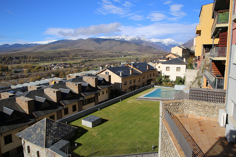
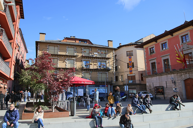
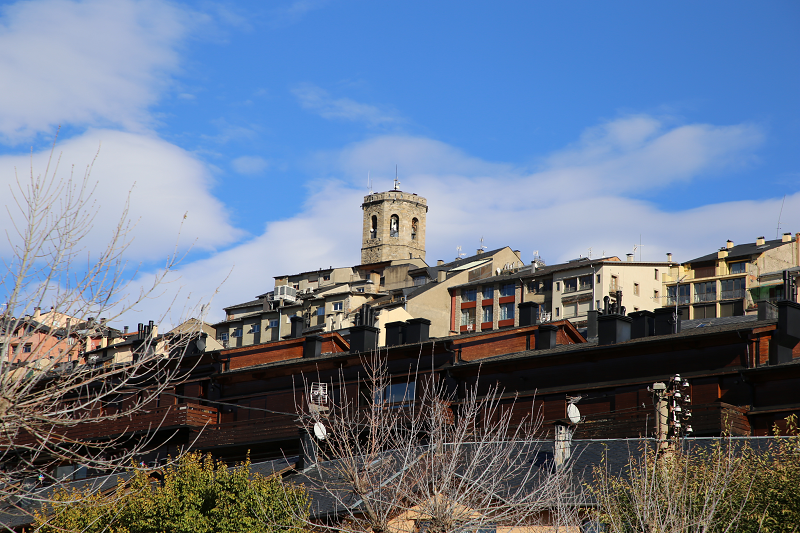
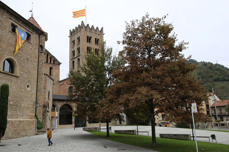
The city is located in a picturesque green mountain gorge where you can find the confluence of two rivers: Ter and Freser.
The first mentions of the presence of people in Ripoll belong to the Bronze Age (1500-600 BC). This information refers to small, disparate settlements near the Ter and Freser rivers, surrounded by mountains. The findings of bronze objects and tools confirm these assumptions.
In the IX century, residents of the surrounding areas began to concentrate around the place that today is called the city of Ripoll. The initiator of the settlement in this area was Count Guifré el Pelós (840-897).
Ripoll, because of its strategic location at the crossroads and because of its early industrial and business activities — the cradle of Catalonia’s industrialization — has always been the focus of French and Spanish military conflicts throughout history.
Throughout its history, Ripoll served as a major industrial center, primarily associated with metallurgy and iron processing. For example, in the 16th and 18th centuries, the city was known throughout Europe for its connection with the production of firearms, mainly cannons and muskets.
However, the equally important role of the city is the cultural heritage of Catalonia. Not without reason, at the end of the 19th century the phrase “Ripoll – the cradle of Catalonia” appeared. And one of the best Catalan writers of all time, Jacint Verdaguer, in his Canigó poem describes the city in the 11th song:
“In Ripoll, we discover the quintessence of modernism in architecture, created during technological progress and industrialization in the vicinity of the Ter and Freser rivers”.
Major tourist attractions and what to see:
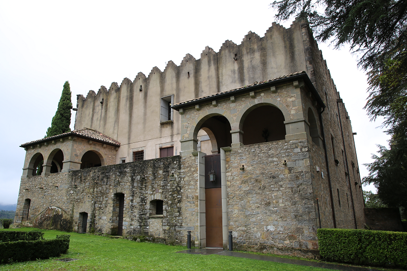
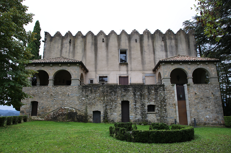
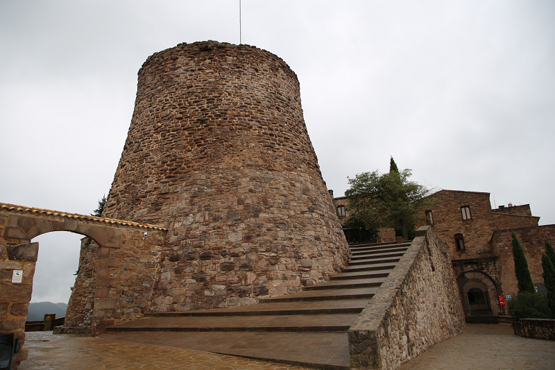
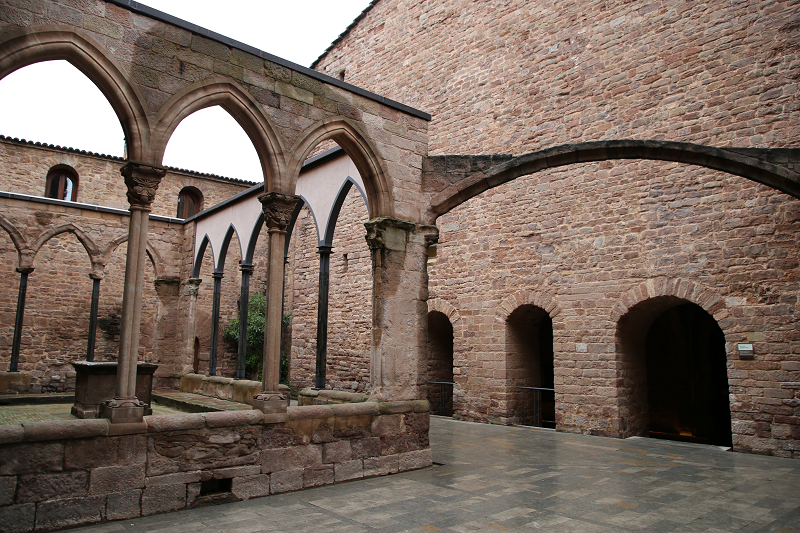
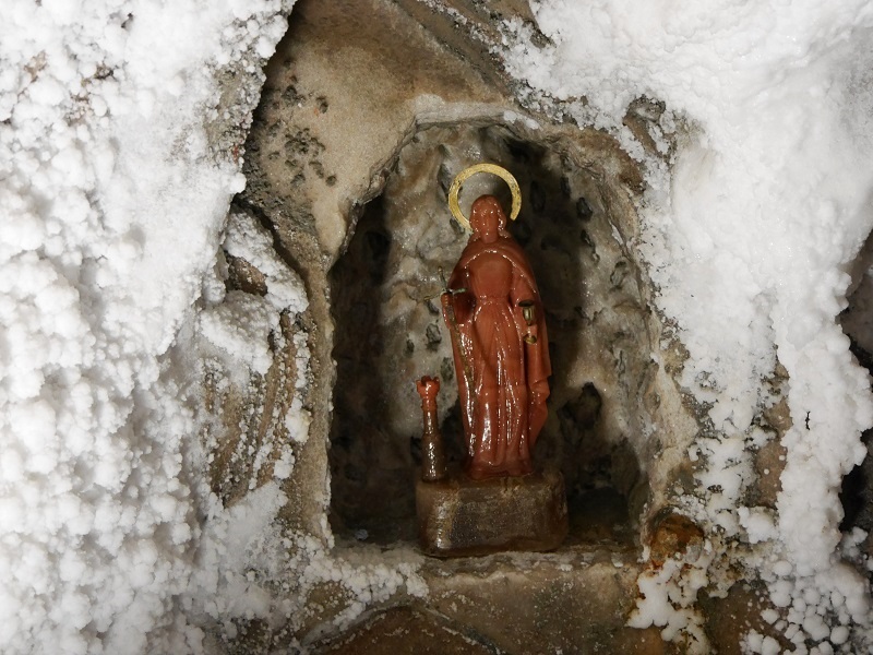
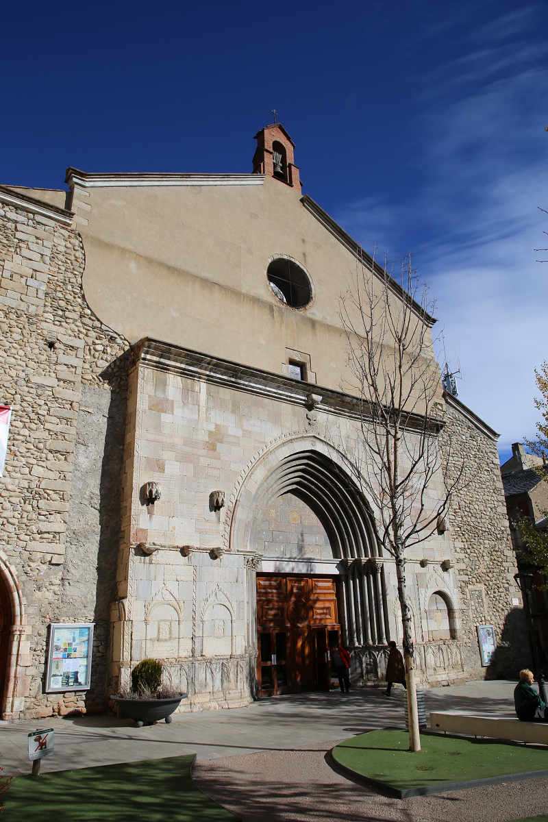
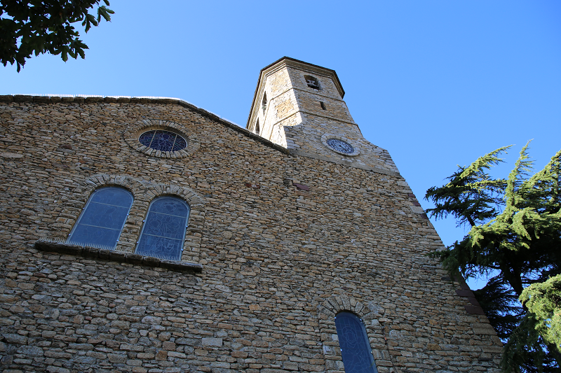
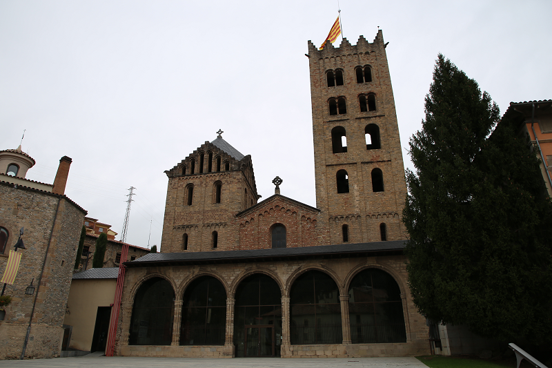
The main architectural landmark of the city is the monastery of Santa Maria de Ripoll. This is one of the most famous and memorable historic buildings in Catalonia. Gothic basilica, vaults and arches make it a must-visit for art lovers. Many famous names in Catalan history are associated with the monastery: Count Gifre the Hairy (Guifré el Pelós), considered as one of the fathers of the Catalan nation, Abbot Oliba, Count Ramon Berenguer III and IV, Bishop Josep.
Opening hours:
Summer schedule (from April 1 to September 30)
Morning: from 10:00 to 14:00.
Afternoon: from 16:00 to 19:00.
Sunday and public holidays: from 10:00 to 14:00
From June 26 to September 11
On Sundays from 10:00 to 14:00 and from 16:00 to 19:00.
Winter hours (from October 1 to March 30)
Morning: from 10:00 to 13:30.
Afternoon: from 15:30 to 18:00.
Sunday and public holidays: from 10:00 to 14:00.
December 25 and 26 and January 1 and 6: CLOSED
December 24 and 31 and January 5: from 10:00 to 14:00.
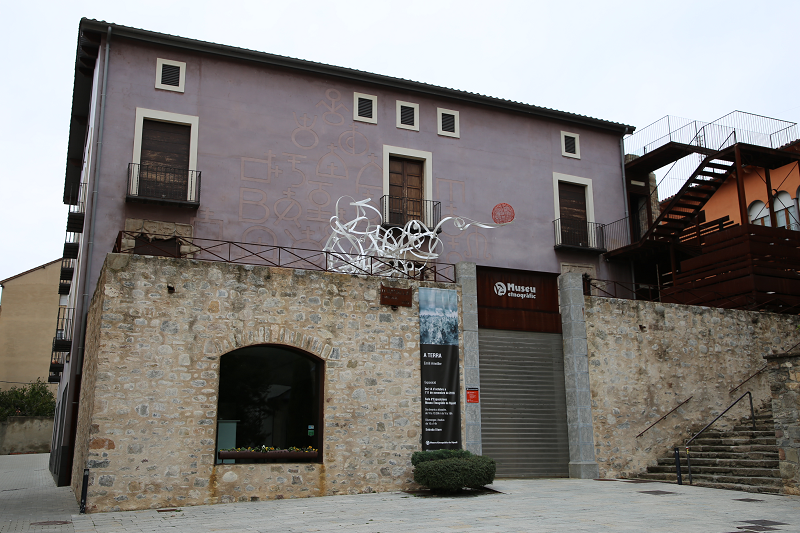
The Ethnographic Museum of Ripoll is also a must-visit as it is considered to be the main ethnographic museum in Catalonia.
The museum, in particular, features the L’Scriptorium Archive, an important tourist attraction in Ripoll. The archive contains the original manuscripts written by the Benedictine monks of the monastery of Santa Maria. Many of the documents date back to the 10th, 11th, and 12th centuries. The archive in Ripoll is named as one of the most important artefacts of Europe from a paleographic, textual and artistic point of view. In particular, in the archive you can see the originals of two great handwritten Bibles from the 11th century.
The L’Scriptorium Archive is a permanent exhibition that, interactively and didactically, makes it possible to discover the cultural past of the Monastery of Santa Maria.
Opening hours:
September to June
From Tuesday to Saturday: from 10:00 to 13:30 and from 16:00 to 18:00
Sunday and public holidays: from 10:00 to 14:00
July August
From Tuesday to Saturday: from 10:00 to 13:30 and from 16:00 to 19:00
Sunday and public holidays: from 10:00 to 14:00
* Mondays of August: from 10 to 14 hours
Prices: 4 euros. The last Sunday of every month is free.
Address: Plaça de l’Abat Oliba s / n 17500 Ripoll, telephone: 972 703 144